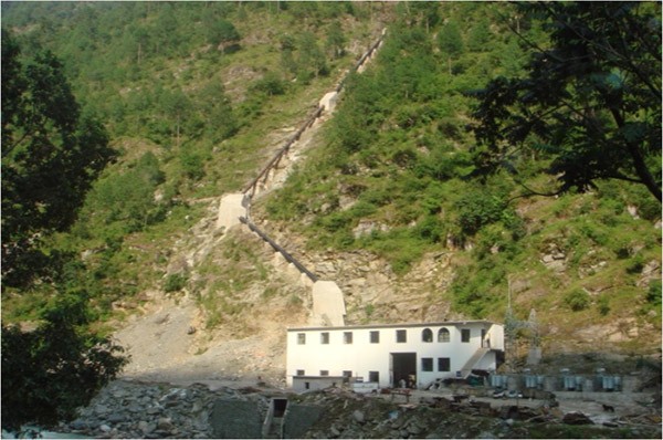
The hydropower project is situated in the Eastern Development Region of Nepal, specifically in the district of Ilam within the Mechi zone. Both the intake and powerhouse sites are located in Danabari VDC. Access to the project site is facilitated via the East-west highway up to Birtamode, followed by a approximately 25-kilometer long blacktopped/graveled link road north from Birtamode. The geographic coordinates range from 87°52'1.92" E to 87°53'9.16" E longitude and 27°45'43.37" N to 27°47'39.78" N latitude, while the altitude varies from 155 to 200 meters above sea level (amsl).
The hydropower project harnesses the waters of the Mai Khola river and is in close proximity to the town of Birtamode Bazar. Functioning as a run-of-river scheme, it operates with a gross head of 42.65 meters and a net head of 34.59 meters. The installed capacity of the project is 7,000 kW, contributing to an estimated average annual energy generation of 38,422,444 kWh. This project serves as a significant source of renewable energy in the region, utilizing the natural flow of the Mai Khola river to generate clean and sustainable power.